Category: Blue Ridge Parkway

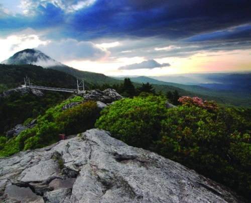
view from trail at Yonahlossee

MP 303.9 – Yonahlossee Overlook

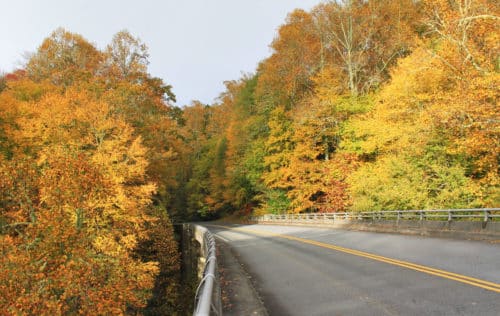
Heading south from Blowing Rock, this overlook is the last one before the Linn Cove Viaduct. There are no views from the overlook itself, but a short walk along the flat  footpath heading toward the Viaduct will provide a wide vista. To the south is the Viaduct (and a great spot for photos with it in the background). To the north, additional sections of the Parkway and its beautiful stonework are visible. Huge views of the valleys below are especially gorgeous in fall, though it’s recommended to visit this popular spot on a weekday or very early morning during leaf season if you want to park at the overlook. Trails: Access path to Viaduct view Views: Linn Cove Viaduct Picnic Tables: No Camping: No

Read More »
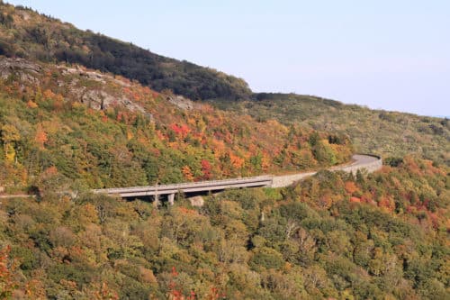
linn cove viaduct

MP 304.4 – Linn Cove Viaduct

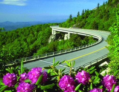
Once known as the “missing link” of the Blue Ridge Parkway, this architectural marvel was the last section of the Parkway to be completed in 1983. It was designed to protect the fragile habitat of adjacent Grandfather Mountain. This 1,243 feet long, concrete, segmental bridge was constructed to eliminate massive cuts and fills, resulting in a complicated bridge, snaking around boulder-strewn Linn Cove in an “S” curve. It remains surrounded by old-growth trees, as very few were removed for its construction. It’s exhilarating to drive over, with wide, unobstructed views to the south.  Explore a bridge museum and visitor center at the south end of the Viaduct. From the visitor center, a trail leads under the Linn Cove Viaduct and continues on to the Tanawha Trail. Trails: Linn Cove Viaduct Access Trail and a connection to the Tanawha Trail Views: Far reaching views Picnic Tables: No Camping: No Visitor Center: Yes

Read More »

Make it Your Nature: Leave No Trace

The Blowing Rock, NC area offers some of the most beautiful, pristine mountains in the state of North Carolina. To preserve this area for generations to come, we must own the impact we have on the environment around us. To this end, Blowing Rock is pleased to partner with Outdoor NC to preserve the natural beauty of North Carolina. It’s up to each of us do our part and join the movement to protect these spaces for generations. The 7 Principles of Leave No Trace provide a simple framework for doing our part! Outdoor NC Leave No Trace Principles 1. Plan Ahead and Prepare North Carolina is home to endless opportunities for outdoor recreation. Learn about the area you plan to visit before you arrive and know the regulations Avoid crowds and increased impact by exploring lesser-known areas, and do your best to avoid times of high use. Remember to always have a backup plan in case the area you’re looking to visit is overcrowded or parking areas are full. Remember food, water and the right clothes to protect you from cold, heat, sun or rain. 2. Stick to Trails and Overnight Right Travel and camp on designated trails and durable surfaces to protect trailside plants. Avoid taking shortcuts or creating new paths. Camp only on existing or designated campsites to avoid damaging vegetation. When camping in nondesignated areas, confine impact to places which already show use and avoid enlarging the area of disturbance. Take rest breaks on durable surfaces well off the designated trail. Poor weather, rip currents and slick rocks around waterfalls often take visitors by surprise. Practice safety and caution, and don’t do anything above your group’s skill level. 3. Trash Your Trash Pack it in. Pack it out. Pack out all trash and litter in garbage bags and carry it home. Litter, including food scraps and cigarette butts, can take years to decompose and is unhealthy for wildlife. If adventuring with your pet, plan to pack out their waste as well. When camping in remote areas, be sure to have a plan to dispose of human waste properly. 4. Leave It As You Find It North Carolina is home to an amazing diversity of indigenous plants and animals. Avoid picking flowers, taking shells, and collecting starfish and pinecones, and take a picture instead. Leave rocks as you find them to protect the sensitive habitats of critters. Stacking rocks can also lead to erosion and ecological impacts. Carving and etching into trees leaves lasting damage and can kill the vegetation. Remember, in national parks and many other protected places, it is illegal to remove natural objects. 5. Be Careful With Fire If you choose to have a fire, make sure it is permitted in the area you are visiting and keep small. Gather wood from the ground on-site if allowed, and avoid breaking living branches from trees. Buy firewood locally. Transporting firewood can introduce harmful invasive species. Burn all wood to ash and be sure the fire is completely out and cold before you leave. If you plan an overnight camping trip, use a stove for cooking. 6. Keep Wildlife Wild North Carolina is home to an abundance of wild animals, and we must treat all wildlife from black bears and wild horses to salamanders and birds with respect. Remember that you are a visitor in their home. Observe wildlife from a distance and never approach or follow them. Getting too close to wildlife causes undue stress and harm. Never feed a wild animal. It alters their natural behavior and puts them, and you, at risk. When camping, store food securely and keep garbage and food scraps out of reach from wildlife. 7. Be Considerate of Other Visitors and Share the Outdoors Everyone has a different definition of what it means to enjoy the outdoors, and everyone has different levels of experience. Be respectful of others’ experience, so North Carolina’s outdoor spaces can be a welcoming and relaxing retreat for all identities and abilities. Be mindful of your noise level so that others around you can listen to nature. It is a general rule that those traveling downhill will yield to those traveling uphill. Be considerate when passing other visitors on the trail. Before passing others, politely announce your presence and proceed with caution.

Read More »
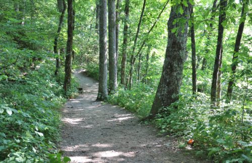
Wooded trail

MP 271.9 – Cascades Overlook & Trail

The easy, 1-mile loop reveals views from two overlooks along the trail, a bridge over Falls Creek, Cascade Falls and a stream. Please be careful around the falls and do not venture off the trail or climb the walls. The Cascades overlook area also offers a large number of picnic tables. Public restrooms and trash disposal are available at this stop. Trails: Cascades Trail Views: Views from trail of Cascade Falls Picnic Tables: Yes Camping: No

Read More »

MP 316.4 – Linville Falls, Campground & Hiking Trails

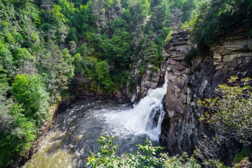
Discover a series of waterfalls that drop to a deep gorge, hiking trails with incredible views, a campground, a visitor center, and a picnic area along the Linville River. The trails range from easy to strenuous. The various trails here include the short walk up Duggers Creek and more strenuous hikes into the plunge basin. Follow the access road from the Blue Ridge Parkway to get to the public parking area. The portion of the river along Spur Road is very popular for trout fishing. The campground is located right along the river bank. Parking is at the visitor center which features gifts and accessories, and offers restrooms, water fountains, and information about both the Falls and the Parkway. Trails start at the visitor center. The shortest is to Duggar’s Creek Falls, a small but beautiful waterfall in a lush cove. Other moderate trails lead to views of the main falls and gorge. The falls are impressive, especially the lower falls, as a massive volume of water rushes into the steep gorge. The plunge basin trails take hikers down into the gorge to areas along the river at the base of the falls. Linville Falls is adjacent to the Linville Gorge Wilderness Area, maintained by the US Forest Service. Primitive trails (not shown below) are available for adventurous hikers in the Wilderness Area, and all are rated very strenuous. Dispersed camping is available in the Wilderness Area and requires permits on certain days. Trails: Yes Views: Upper and Lower falls views accessed by trails Picnic Tables: Yes Camping: Yes Features: Waterfall

Read More »
boone fork trail

MP 296.5 – Boone Fork Trail & Falls

The Boone Fork Trail is a moderate 5.2-mile hike that traverses streams and goes through tunnels of rhododendron. The path is incredibly varied, with multiple stream crossings, boardwalks over boulders, pastures filled with wildflowers, and views of beautiful waterfalls.  In fact, Hebron Falls can be accessed about 1 mile down the trail (head to the right from the trailhead). This trail is a favorite for many locals! The trailhead is located at the Price Park Picnic Area, which has plenty of parking and lots of picnic tables. Public restrooms are available at the trailhead as well. Trails: Boone Fork Trail – moderate Views: Waterfall, meadow, streams Picnic Tables: Yes Camping: No

Read More »
Sim's Creek bridge

MP 295.3 – Sims Creek Overlook & Green Knob Trail

Sims Creek Overlook is a great access for the Green Knob Trail, a 2.3-mile loop. From the overlook parking area, a set of steps leads to the trail, first passing directly through dense thickets of rosebay rhododendron. It’s a fantastic spot to view this particular rhododendron bloom, which usually peaks in the Blowing Rock area around late June to early July. The trail itself is varied, going under the bridge and through pastures, along Sims creek, and through forests. The trail nears the top of Green Knob, so there are some sections of the trail with long climbs. The Sims Creek bridge is an excellent spot for fall color viewing, with a pedestrian sidewalk on each side. The view is a close one, but packed with a variety of deciduous trees growing along the banks of the creek. Trails: Green Knob Trail Views: View of Sims Creek Bridge, pastoral views along trail Picnic Tables: No Camping: No

Read More »
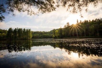
Price Lake at Julian Price Park on the Blue Ridge Parkway

MP 297 – Julian Price Memorial Park

Enjoy 4,200 acres of rolling mountains with elevations ranging from 3,400 to nearly 4,000 feet, plus a lake, stream, hiking trails, and a campground at Julian Price Memorial Park on the Blue Ridge Parkway at Milepost 297. Julian Price was an insurance executive in the early 1900s who prospered as a principal developer of the Jefferson Standard Life Insurance Company, which later became Jefferson-Pilot Life Insurance Company. Price purchased the 4,200 acres in the 1930s to provide a recreation area for his employees. When he died in 1946, his heirs left the land to the Blue Ridge Parkway as a memorial to him. Directly adjacent to the Moses H. Cone Memorial Park, together the two parks comprise the largest developed area set aside for public recreation on the Parkway. Price Park is home to the largest campground on the Parkway and is a popular picnic spot. Visitors enjoy interpretive programs, fishing, canoe and kayak rentals at Price Lake, and an extensive trail system. Trails: Green Knob Trail, Boone Fork Trail, Mountains-to-Sea Trail, Price Lake Trail, Tanawha Trail Views: Lake, mountain, stream, and meadow views Picnic Tables: Yes Camping: Yes Other Features: Canoe & kayak rentals      Price Lake Formed in the 1940s by damming up Boone Fork Creek, the focal point of Julian Price Memorial Park is the 47-acre Price Lake. The Lake offers fishing, canoe, single and double kayak, and paddleboard rentals, a 2.5-mile hiking loop around the lake, and a 300 seat amphitheater for interpretive programs. The picturesque lake is set against the backdrop of Grandfather Mountain with a view of Calloway Peak. Price Lake is open to fishing for anyone with a valid Virginia or North Carolina fishing license. Swimming is not allowed. HIKING TRAILS Boone Fork Trail Green Knob Trail MODERATE 2.3 miles, loop Dogs allowed on leash Start at Sim’s Pond Parking Area, (milepost 295.9) Leads to the top of Green Knob and a distant view of Price Lake followed by a view of Calloway Peak on the horizon. Boone Fork Trail MODERATE TO STRENUOUS5.5 miles, loopDogs allowed on leash   Access the trail at the wooden footbridge in Price Park Picnic area (milepost 296.4). Trail features streams, pastures, rock outcrops, meadows, and shaded forest.         Price Lake Loop Trail Price Lake Trail EASY2.7 miles, loopDogs allowed on leash Access this trail from the Price Lake Overlook (milepost 296.7) or the Boone Fork Overlook (milepost 297.1). This trail circles the shoreline of 47-acre Price Lake.  Tanawha Trail EASY TO MODERATE13.5 milesDogs allowed on leash The 13.5-mile Tanawha Trail leaves Boone Fork Trail near Price Park Campground. Wander through fields and by streams, skirting the flanks of Grandfather Mountain, ending at Beacon Heights (milepost 305.5). Parking and access for the Tanawha Trail in Price Park are available at the Boone Fork Overlook (milepost 297.1).  Boone Fork Trail The Mountains-to-Sea Trail The Mountains-to-Sea Trail runs jointly with the Boone Fork Trail for half its length. Signs indicate entry and exit points. The Mountains to Sea Trail stretches 1,175 miles from the Great Smoky Mountains to the Outer Banks.   Picnicking Over 100 picnic sites are available and restrooms are available seasonally. Sites and restrooms are wheelchair accessible with assistance. Camping Price Park Campground has 129 tent sites and 68 RV sites. Sites on Loop “A” are located near Price Lake. Reservations can be made for portions of this campground online at www.RECREATION.gov or by calling 1-877-444-6777. One backcountry campsite requiring a hike is available, and a permit must be obtained from the campground during the season. For more information, call 828-963-5911 or 828-295-7591. During the summer, rangers present programs on various topics at the amphitheater located in the campground.

Read More »
Flat Top Manor - Moses Cone Memorial Park on the Blue Ridge Parkway

MP 294 – Moses Cone Memorial Park

The Carriage, Horse & Hiking Trails Enjoy 25 miles of beautiful carriage roads. Visit Cone Cemetery on your way to Flat Top Tower, where you will find stunning views. Explore the apple orchards, walk around Bass Lake, investigate the Maze and apple barn. Most trails are multi-purpose and open to horseback riders, joggers, hikers, and cross-country skiers. Help preserve these historic trails by staying on the designated paths and LEAVE NO TRACE. Horseback Riding on Rich Mountain Trail View of Flat Top Manor from Bass Lake Flat Top Mountain Trail View from Flat Top Tower Rich Mountain Carriage Trail MODERATE2.6 miles (5.2 miles total, out and back)Dogs allowed on leash Flat Top Mountain Carriage Trail MODERATE2.8 miles (5.6 miles total, out and back)Dogs allowed on leash Watkins Carriage Trail MODERATE3.3 miles (6.6 miles total, out and back)Dogs allowed on leash Black Bottom Carriage Trail EASY.5 mile (1 mile total, out and back)Dogs allowed on leash Bass Lake Carriage Trail EASY0.9 miles (loop)Dogs allowed on leash Deer Park Carriage Trail MODERATE1.2 miles (2.4 miles total, out and back)Dogs allowed on leash Maze Carriage Trail MODERATE2.3 miles (4.6 miles total, out and back)Dogs allowed on leash Duncan Carriage Trail MODERATE2.5 miles (5 miles total, out and back)Dogs allowed on leash Rock Creek Bridge Carriage Trail EASY1 mile (2 miles total, out and back)Dogs allowed on leash Figure 8 Trail Loop EASY.7 mile (loop)Dogs allowed on leash Trout Lake Carriage Trail Loop EASY1 mile (loop)Dogs allowed on leash The Southern Highland Craft Guild Store On the first floor of Flat Top Manor, you’ll find exquisite handmade crafts from members of the Southern Highland Craft Guild. Enjoy seasonal craft demonstrations. April-May Hours: Wed-Sun from 10 am to 4 pm (open for season April 15) June-October Hours: Daily from 10 am to 5 pm November Hours: Wed-Sun from 10 am to 4 pm | Closed Thanksgiving | Last day of the season is November 27 CLOSED November 28-April 14

Read More »
Thunder Hill Overlook view with couple in Mercedes convertible

MP 290.4 – Thunder Hill Overlook

Enjoy a nearly 180° panoramic view! Thunder Hill is one of the most popular places to view the sunrise on the Blue Ridge Parkway. Locals also flock to the location to watch thunderheads coming in from the south, and to view plenty of stars at night. And yes, it’s true that you can see the Charlotte skyline from this overlook! The best time to see it is on a clear winter morning, when cold conditions eliminate haze. The parking area is fairly large, making the overlook accessible even when fairly busy. Views can also be enjoyed across the Parkway from the overlook. Cross the road and climb the slight rise to see a pastoral scene over the cattle fence- and maybe even a few cows! A stile gate in the fence allows the passage along the Mountains to Sea Trail, which runs closely along the Blue Ridge Parkway in the Blowing Rock area. Trails: Access the Mountains to Sea Trail Elevation: 3795′ Views: Very wide view, south-southeast Picnic Tables: No Camping: No

Read More »