
October is all about fall foliage, and many local trails can be very busy during leaf season. We headed to some less well-known spots: Emerald Outback at Beech Mountain, more of Tanawha Trail, and a group hike on Boone United Trail. We also enjoyed an easy stroll around Valle Crucis Community Park, which has lots of parking and space to spread out. In October, we recommend getting started early in the day for a better trail experience; outdoor places here get busier after 10am. If you can explore these places on a weekday, you’ll see fewer other folks then as well. As always, please remember to pack plenty of water and snacks, and to do some research before you set out on your hiking experience. Read along below, and see what we’ve been up to in October.
Emerald Outback Trails
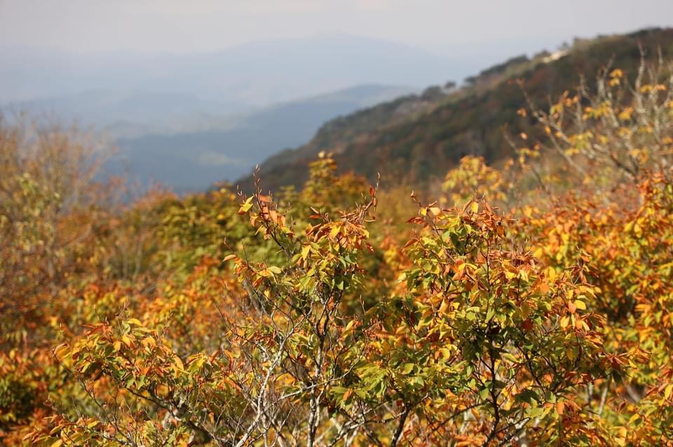
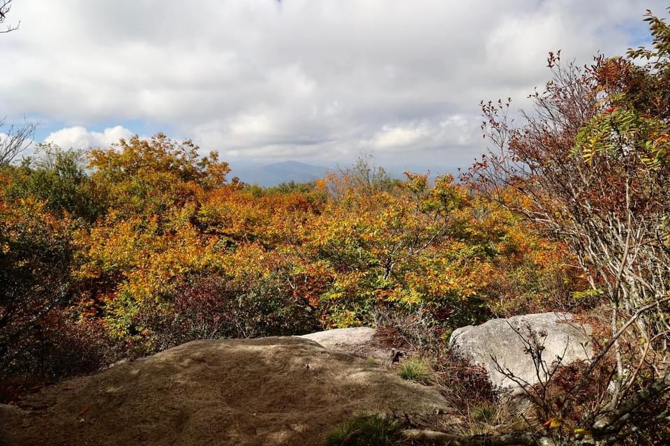
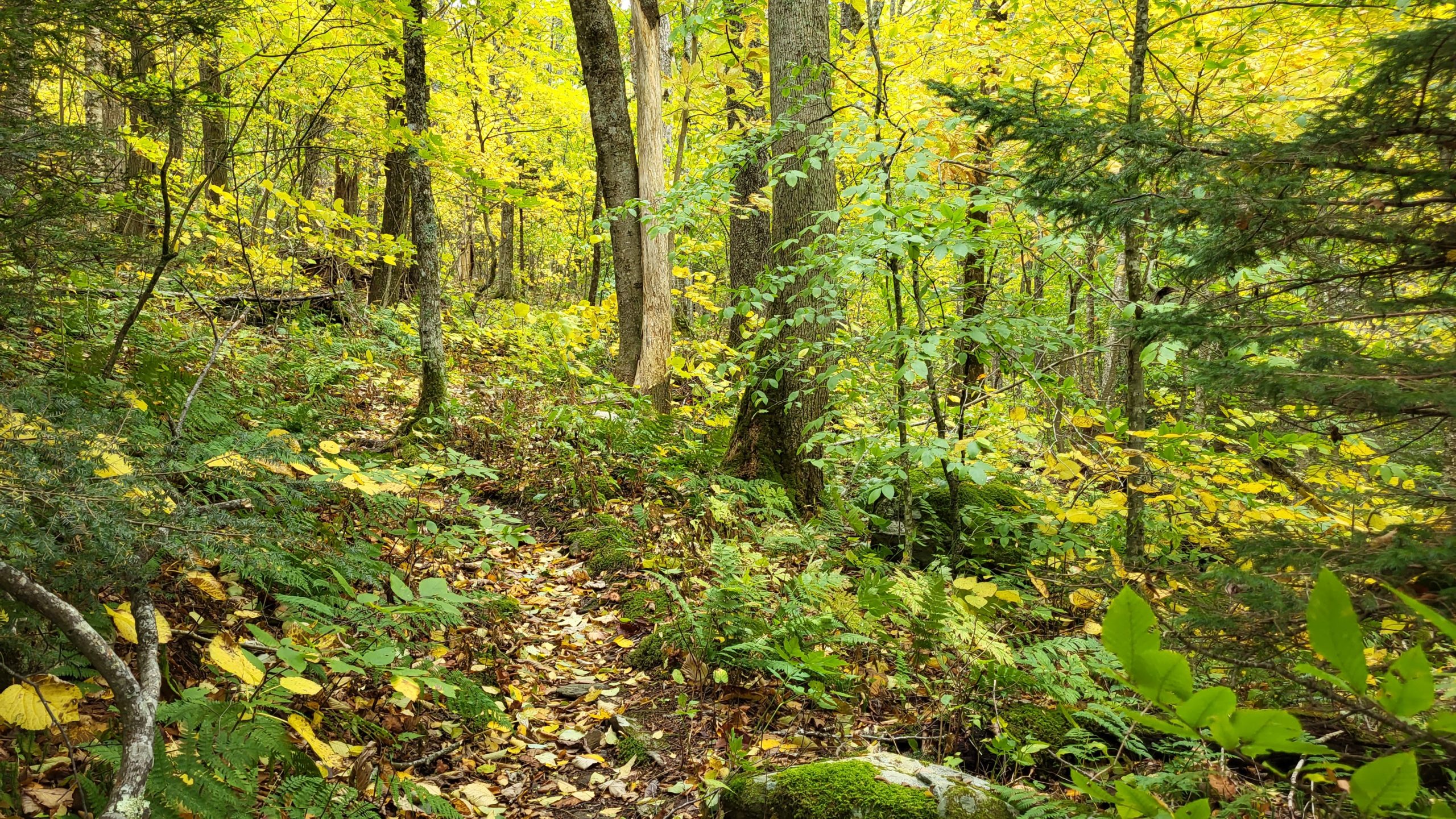
If you’re looking for a versatile hike geared towards mountain biking and some great views, look no further than the Emerald Outback Trails at Beech Mountain. With several unique paths along this 7 mile trail network, Emerald Outback is open year round to the public and great for hiking, mountain biking, bird watching and more!
This is a popular trail throughout the busiest months in the High Country, but with ample parking and lots of routes to explore, you can still enjoy plenty of solitude! We completed the Wizards Way and Oz Forest Run sections of the trail earlier in the month, and were thrilled by the well maintained pathways, clearly marked signage, and diversity of foliage around us. The Wizards Way (marked with blue blaze) is a wonderful short distance path that is the most accessible of the network and doesn’t require walking sticks or hiking boots. The Oz Forest Run is a longer trail which provides a wonderful 180-degree view of Roan Mountain.
Trail Length: 1.5 mi
Difficulty: Easy to Moderate
Surface: natural terrain
Trail Use: hiking, biking, leashed dogs ok
Blaze: blue blaze
Our total distance was about 1.5 miles, which took us just under 2 hours to complete (taking into account time we stopped to admire the views). Emerald Outback Trail Network is located atop Beech Mountain, 25 miles south of Blowing Rock, which is about an hour drive from downtown Blowing Rock.
Getting There:
Take US-221 toward Linville. Turn right at the turn off for the Blue Ridge Parkway, then take an immediate left onto Shulls Mill Rd. Take Shulls Mill Rd. all the way to NC-105. Turn left onto NC-105 S and follow it until the stoplight at Tynecastle. Turn left onto Tynecastle Highway and take it until it dead ends with Main St. in Banner Elk. Turn left onto Main St. then make a slight right to keep you on route, but the road name changes to Beech Mountain Parkway. Follow Beech Mountain Parkway for 4.9 miles then take a slight left onto Village Rd. Continue on Village Rd. then turn left onto N. Pinnacle Ridge Rd. Stay on N. Pinnacle Ridge Rd. and Emerald Outback will be on your right.
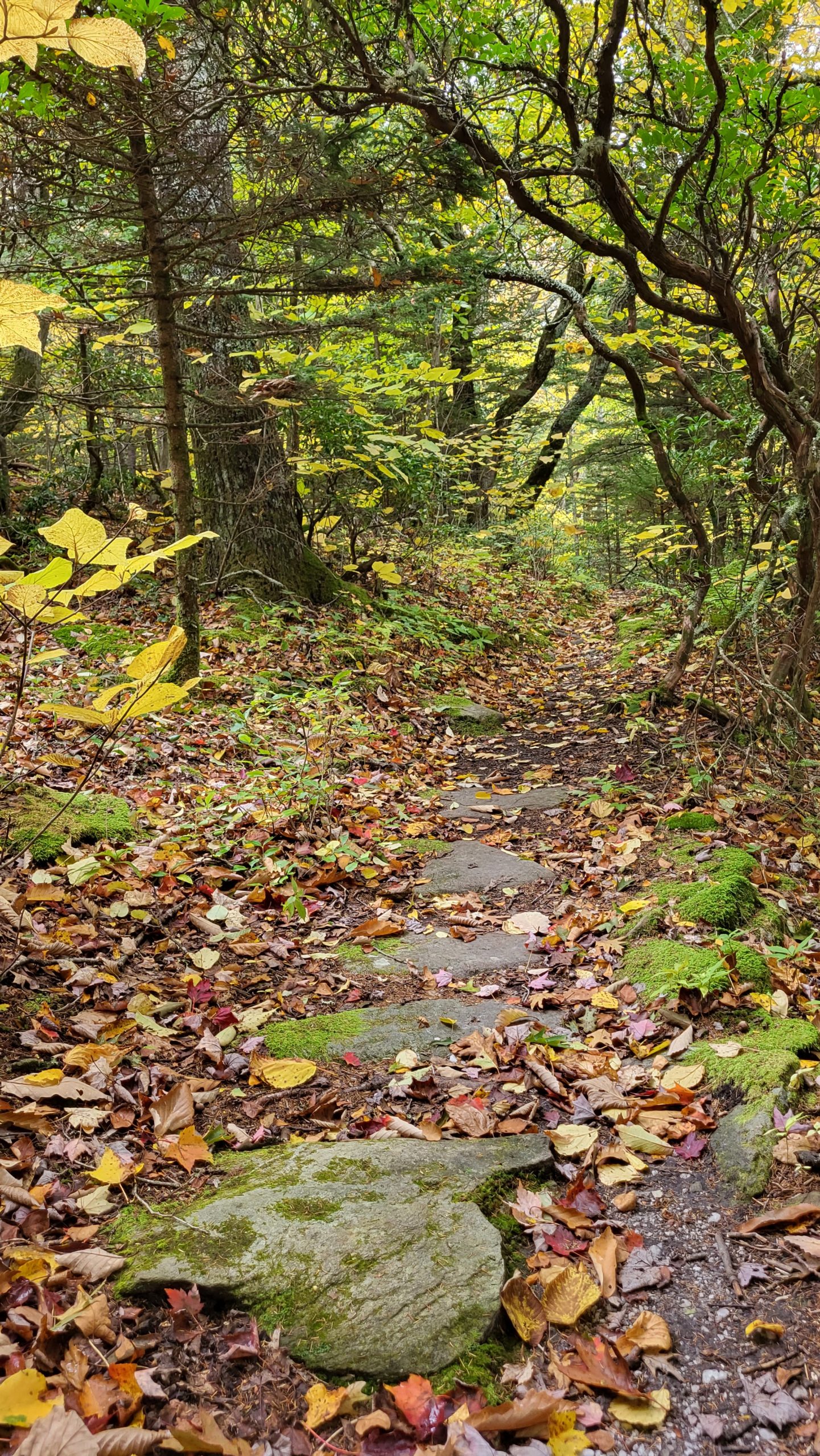
Tanawha Trail: Boulder Field to Boone Fork
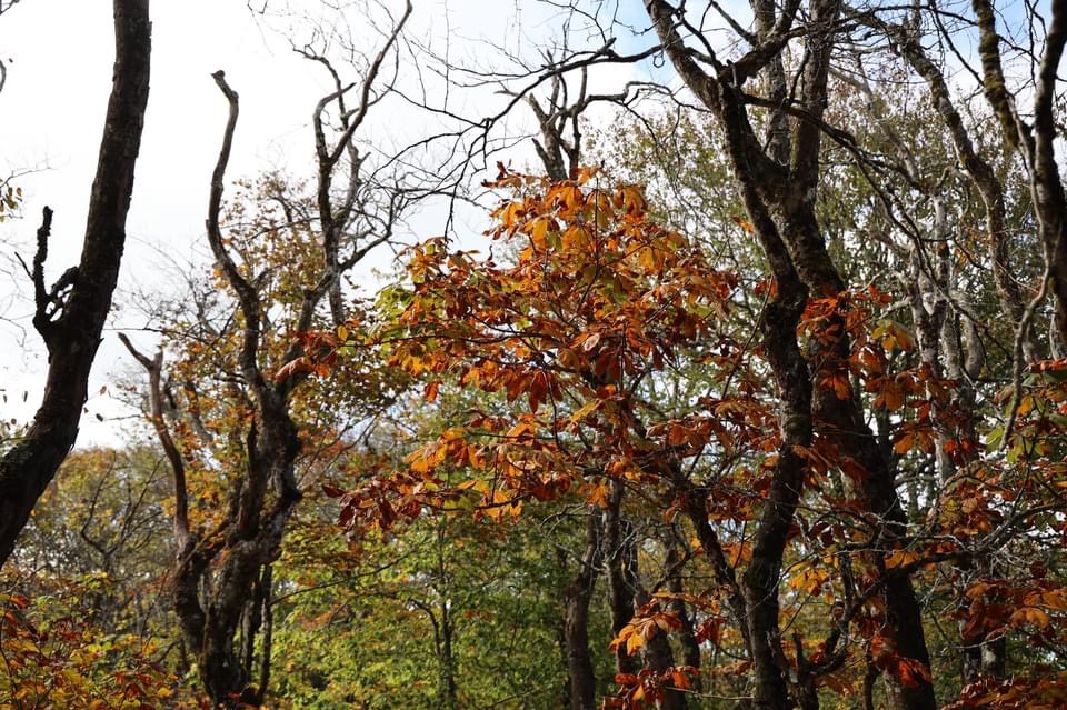
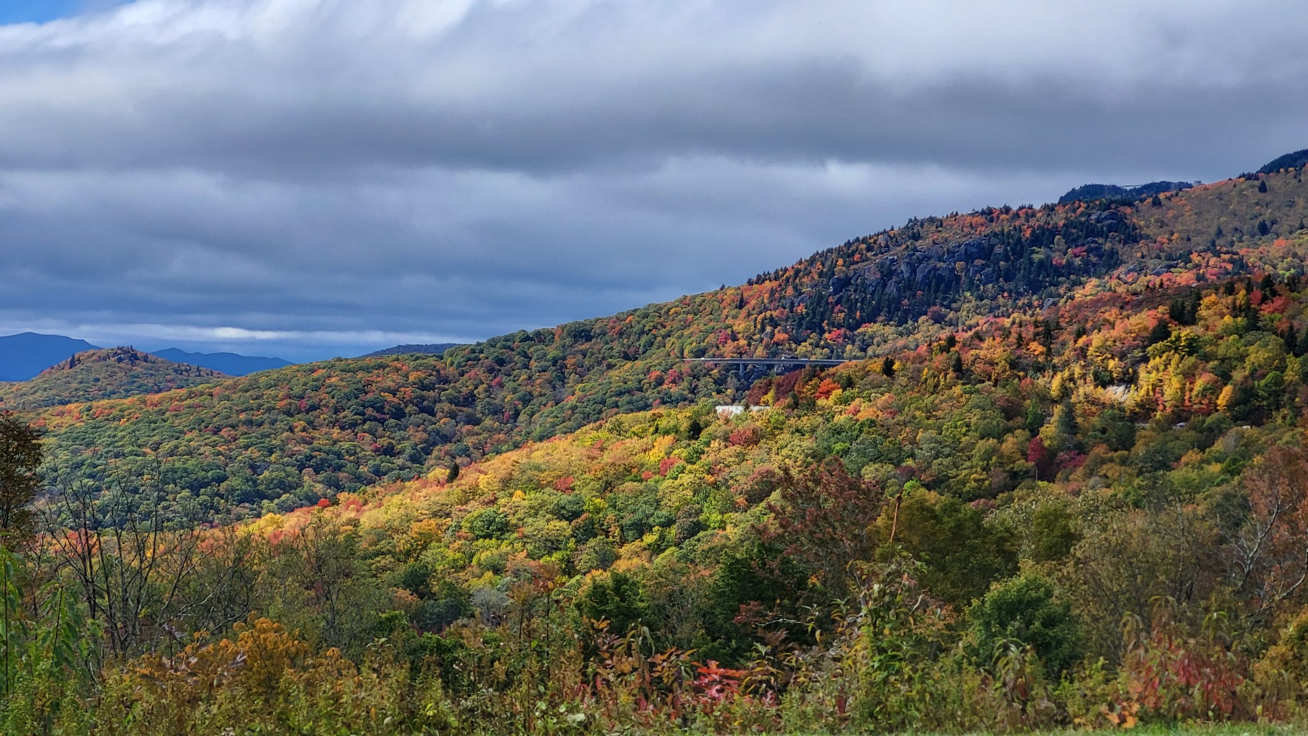
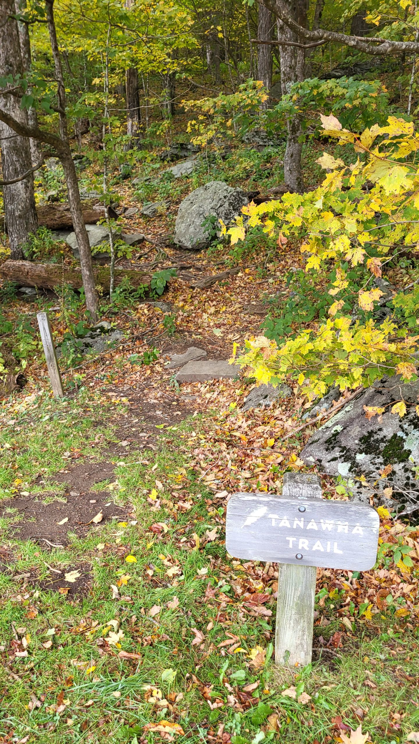
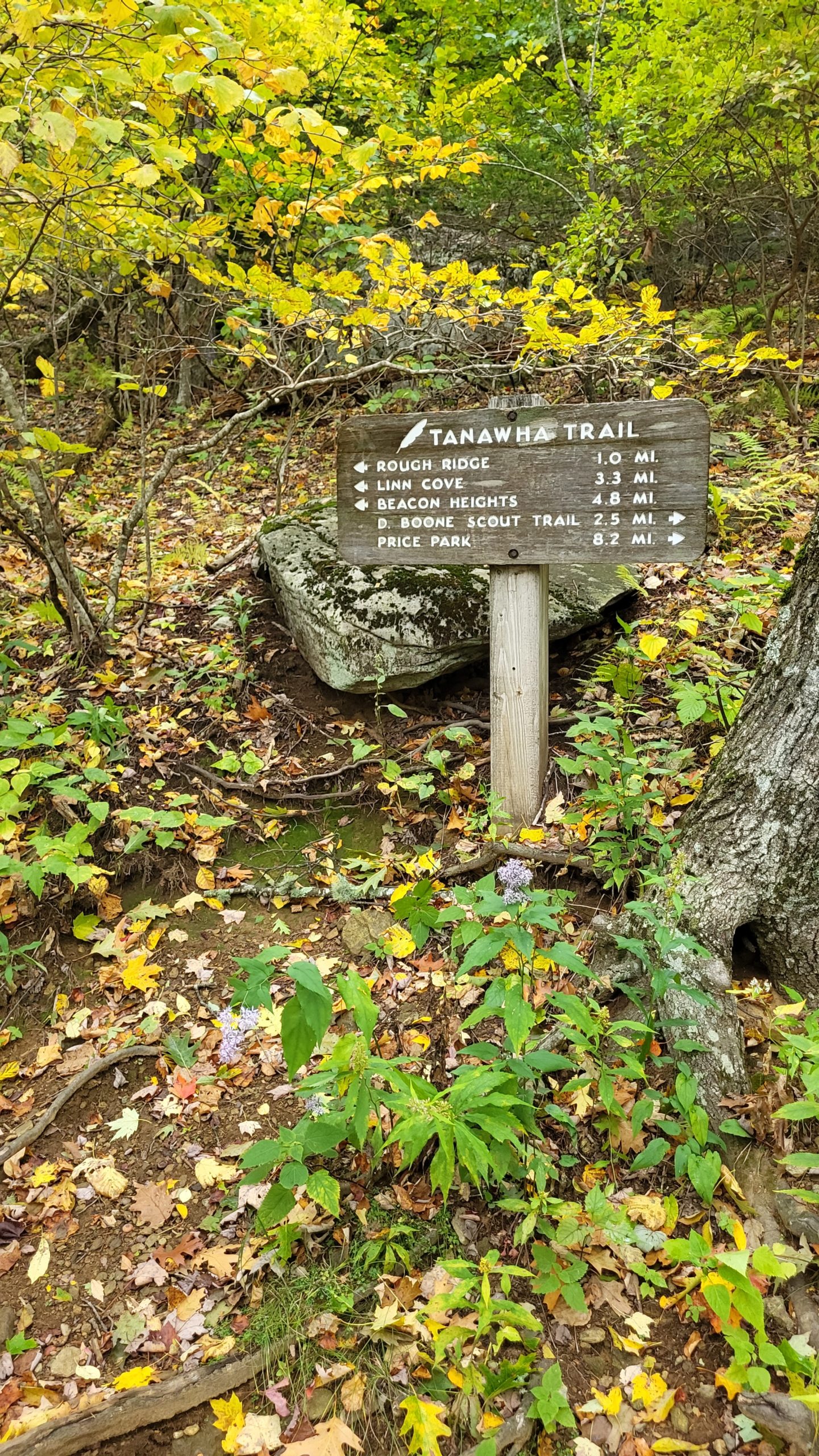
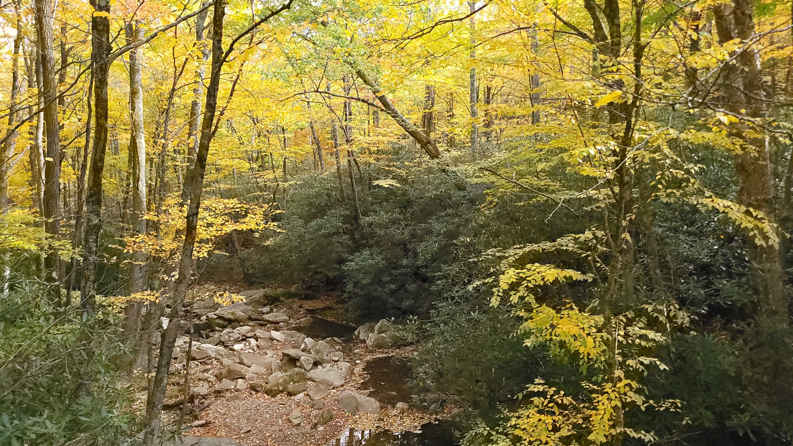
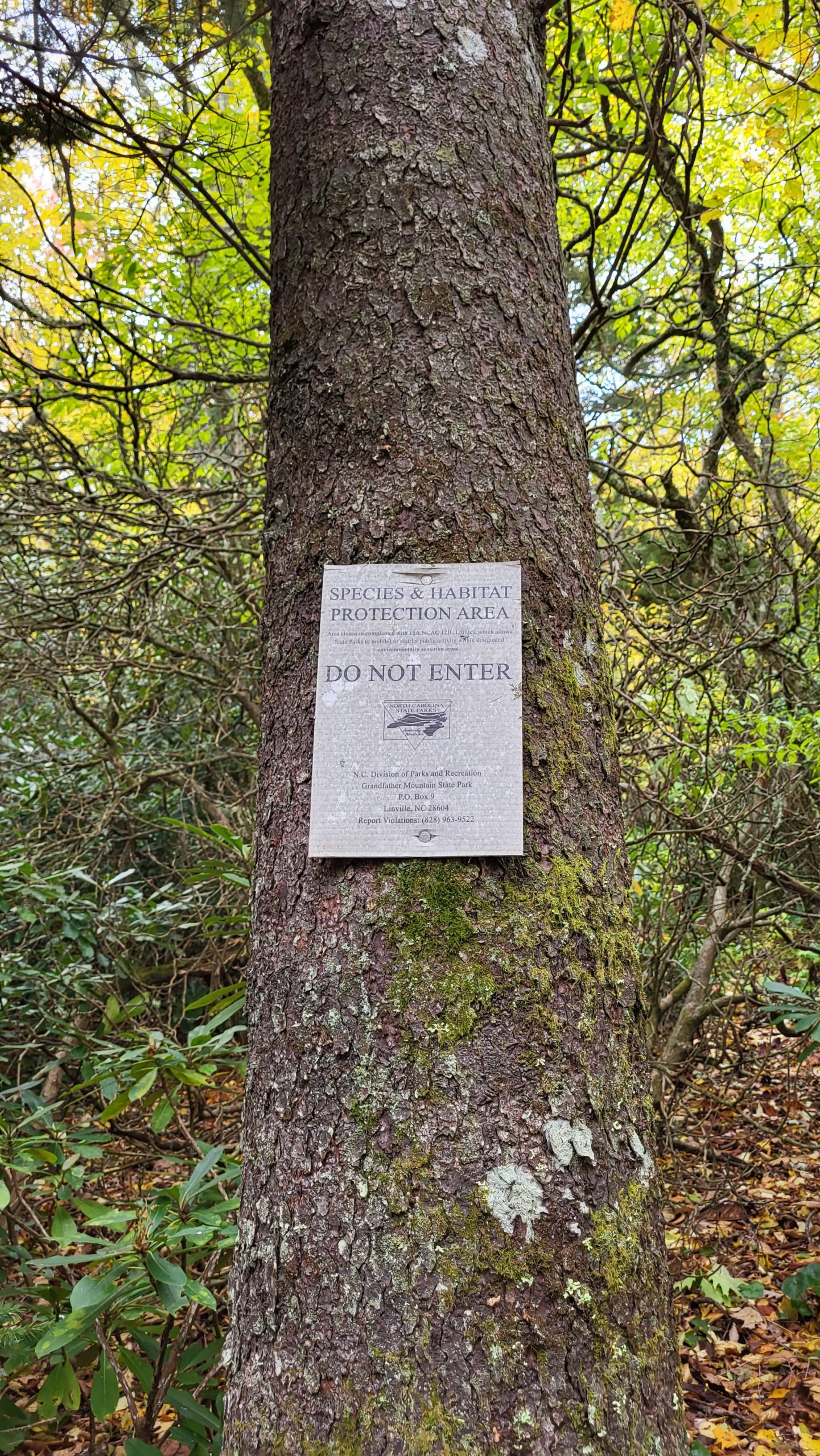
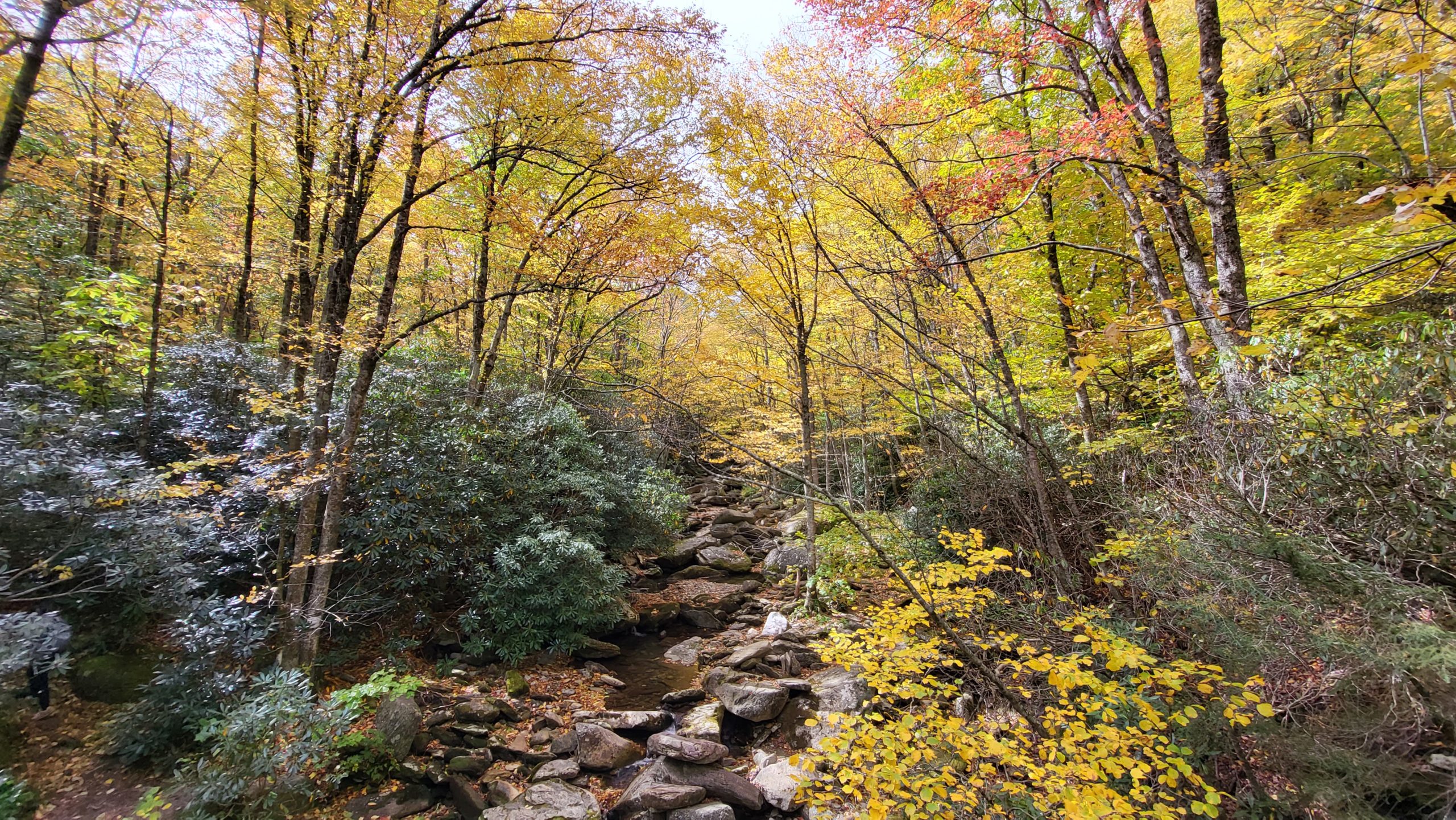
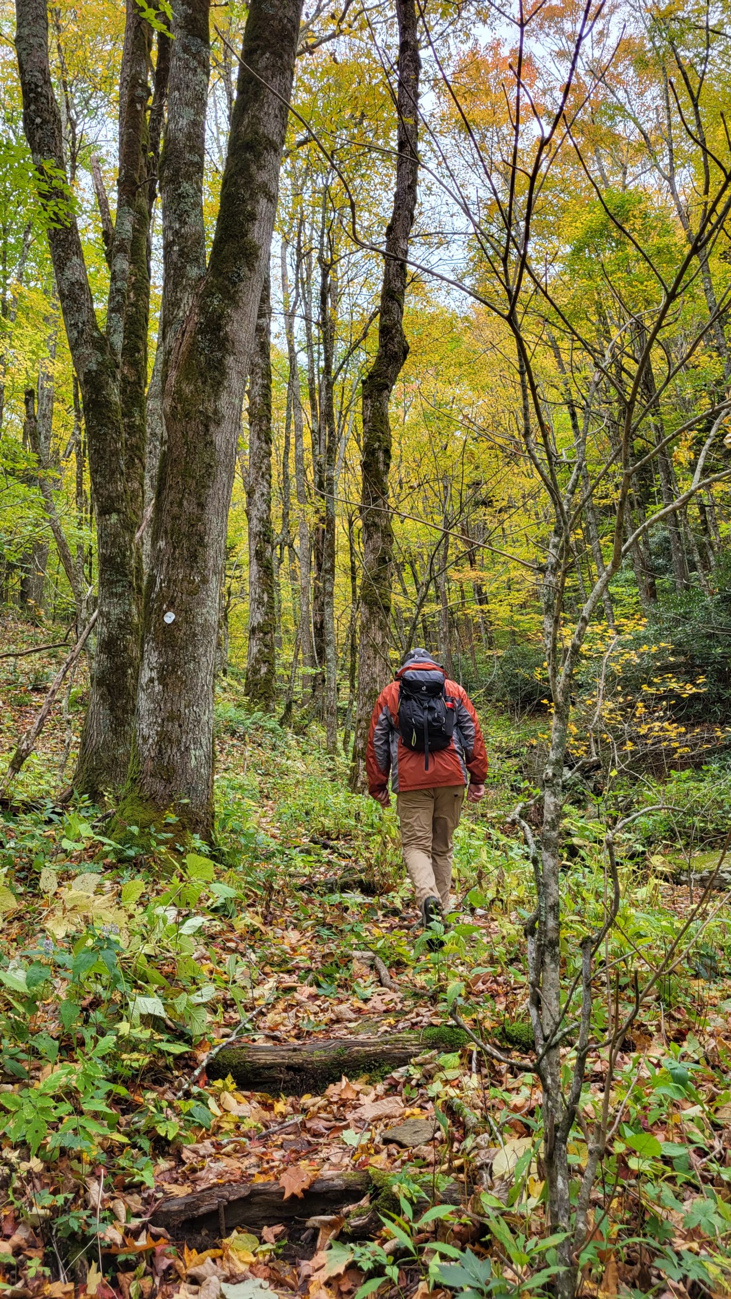
This week’s hike was along a portion of the Tanawha Trail, from Boulder Field Overlook to Boone Fork Overlook. This is a less-traveled section of the Tanawha Trail so the path is narrow in some places, with plants growing close. It’s a gorgeous route for those who are looking for a quiet hike through the woods. The trail borders a Species and Habitat Protection Area, so take extra care to stick to the trail here. The trail is moderate along this section, though some root-heavy sections were a little tricky under a fresh layer of fallen leaves. The path travels through rhododendron thickets, sections of evergreens, and a grove of towering oak trees.
Trail Length: 3.1 miles
Difficulty: moderate
Surface: narrow dirt path, some rocky areas
Trail Use: hiking
Blaze: white feather or white dot (shares route with NC Mountains to Sea Trail)
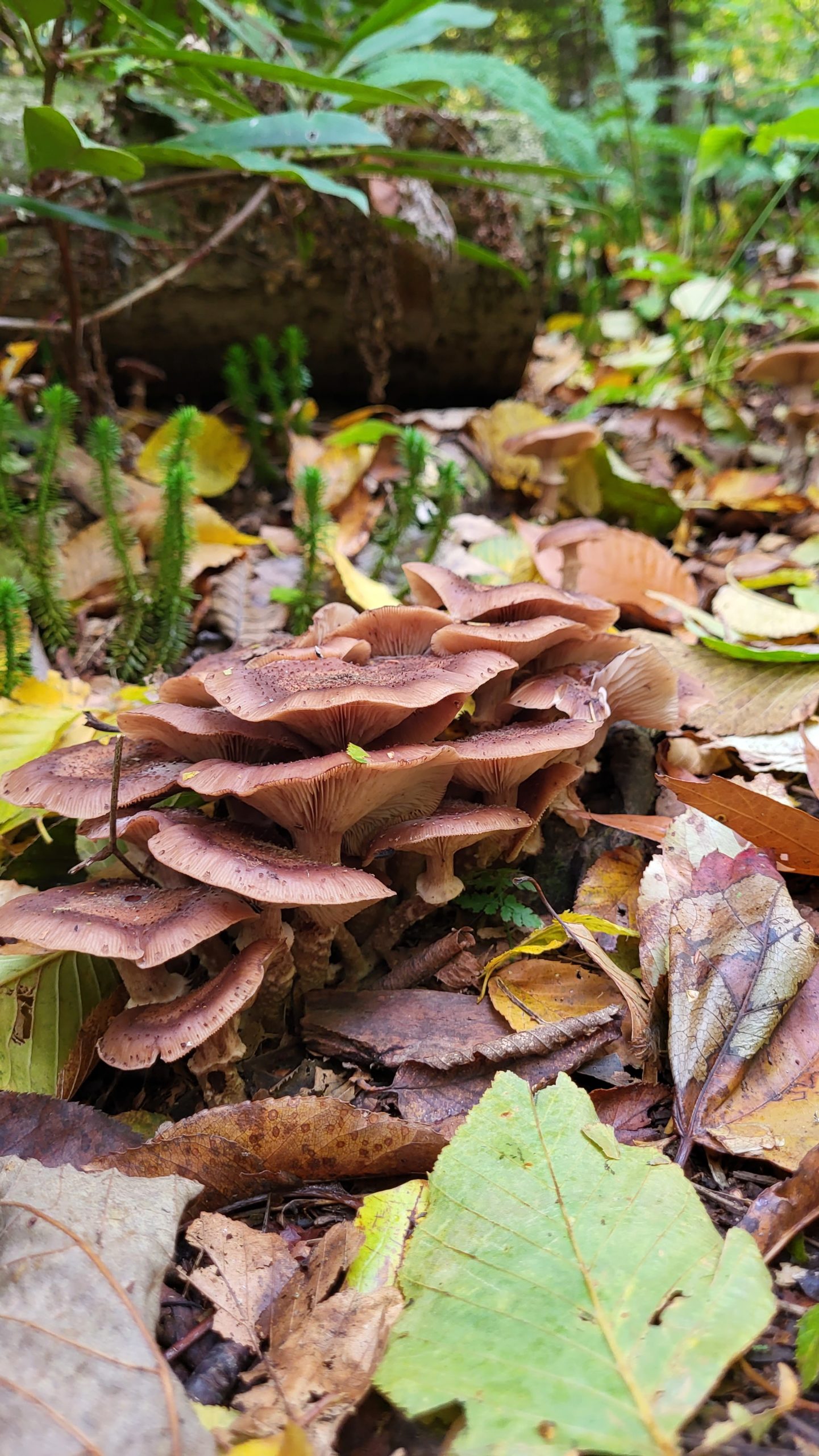
From Boulder Field Overlook, access the trail via a marked connection that heads up the slope. A directional sign for Tanawha Trail is found at the junction; head toward Daniel Boone Scout Trail. On the day of our hike, the woods were full of golden foliage and the path was already strewn with a thick layer of fallen leaves. This did make the trail a bit hard to see in some spots, but the white blazes are plentiful enough to follow. The trail rises and falls in gentle climbs, starting in a moist forest of mixed hardwoods and evergreens. It continues to a few shallow stream crossings and through ever-changing environments that showcase the diversity of local flora. In the first portion of the trail, we spotted lots of blue genetian, a native wildflower that blooms in early fall. Mushrooms were plentiful, as were various lush ferns and bright club mosses. The trail continues to the junction with Daniel Boone Scout Trail, one of the backcountry trails inside Grandfather Mountain State Park. It’s another 0.6 miles to the Boone Fork Parking Area, which is the end of this hike. This portion of the trail intersects with several others, so watch the signs closely! It took us just over 2 hours to complete this hike one-way.
Getting There:
From Blowing Rock, head south on the Blue Ridge Parkway toward Linville. Boulder Field Overlook is located on the right at milepost 302.4. There is an impressive view of the Linn Cove Viaduct from the other side of the roadway. If traveling with two vehicles to hike the trail one-way, park one of them at Boone Fork Overlook at milepost 299.9, which is also on the right when heading south on the Parkway. For reference, Blowing Rock is located at milepost 294.
Boone United Trail
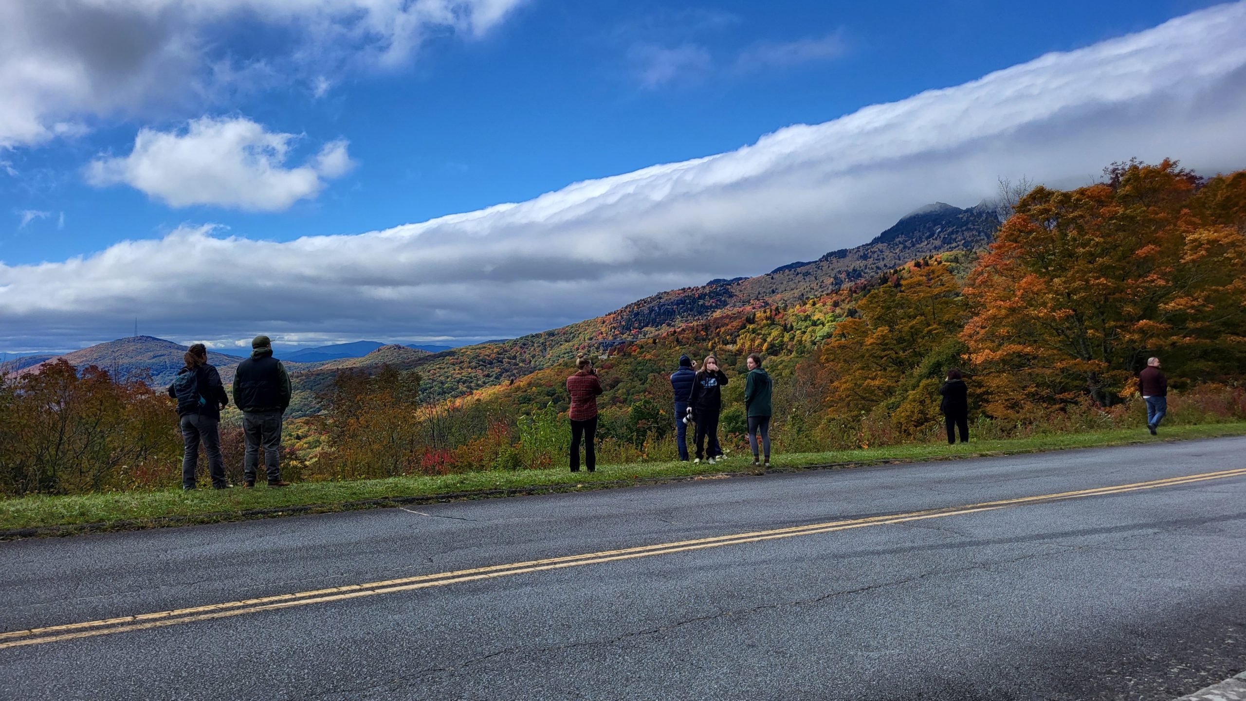
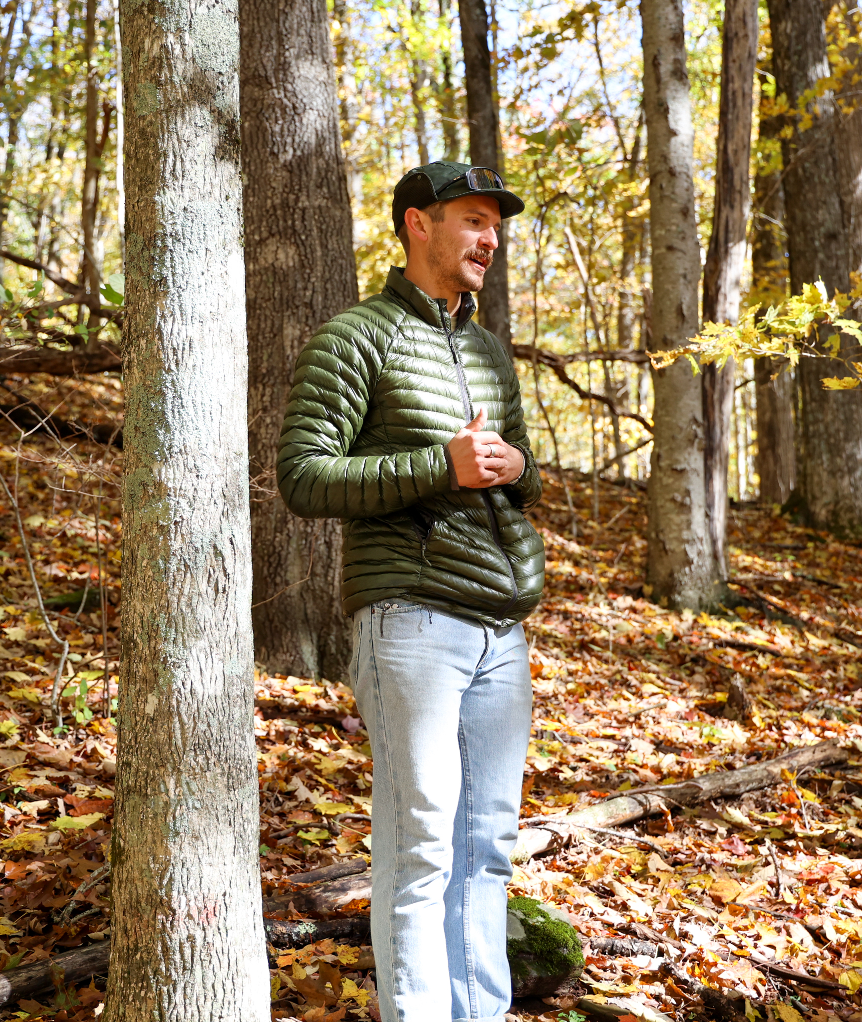
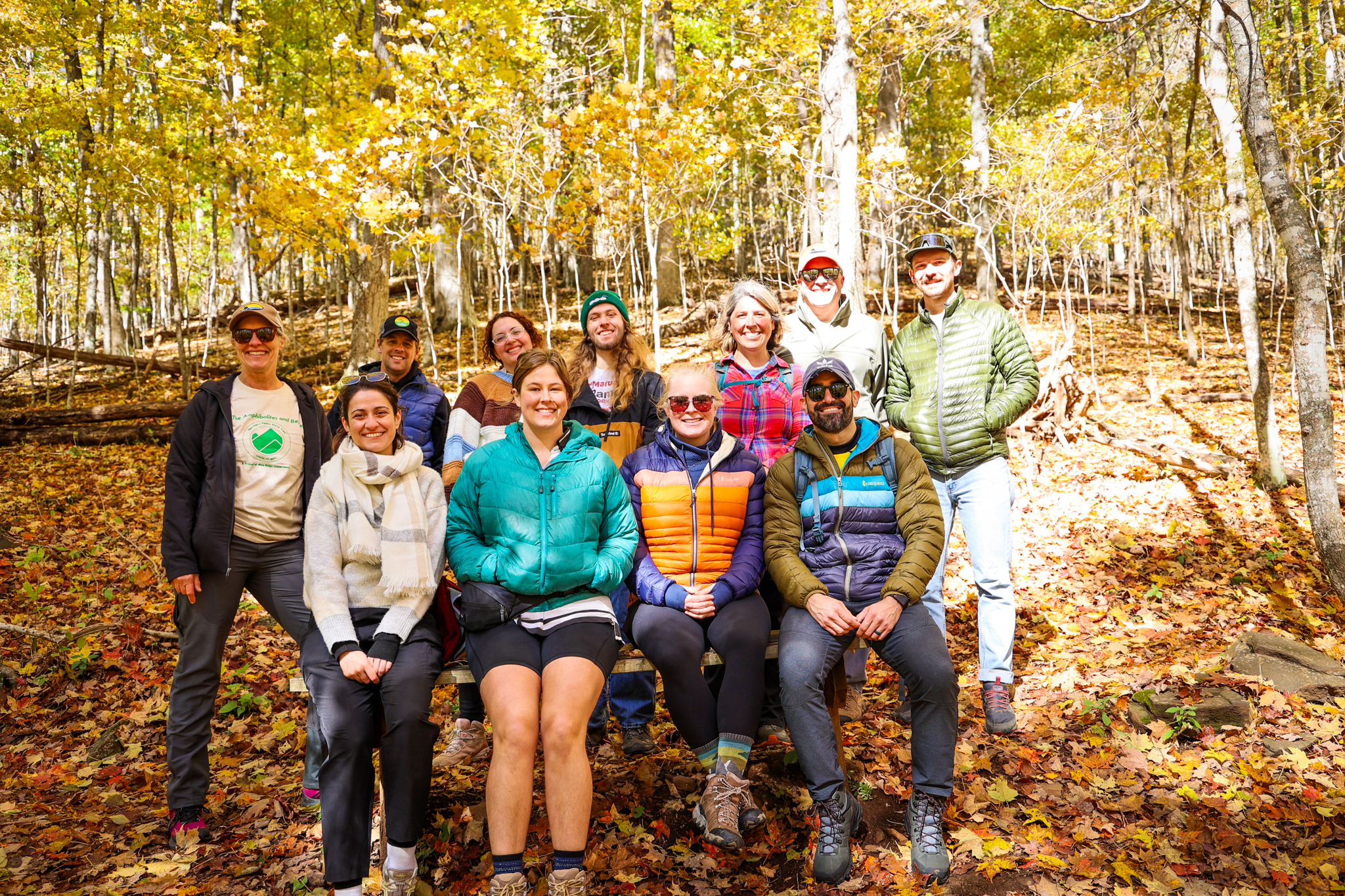
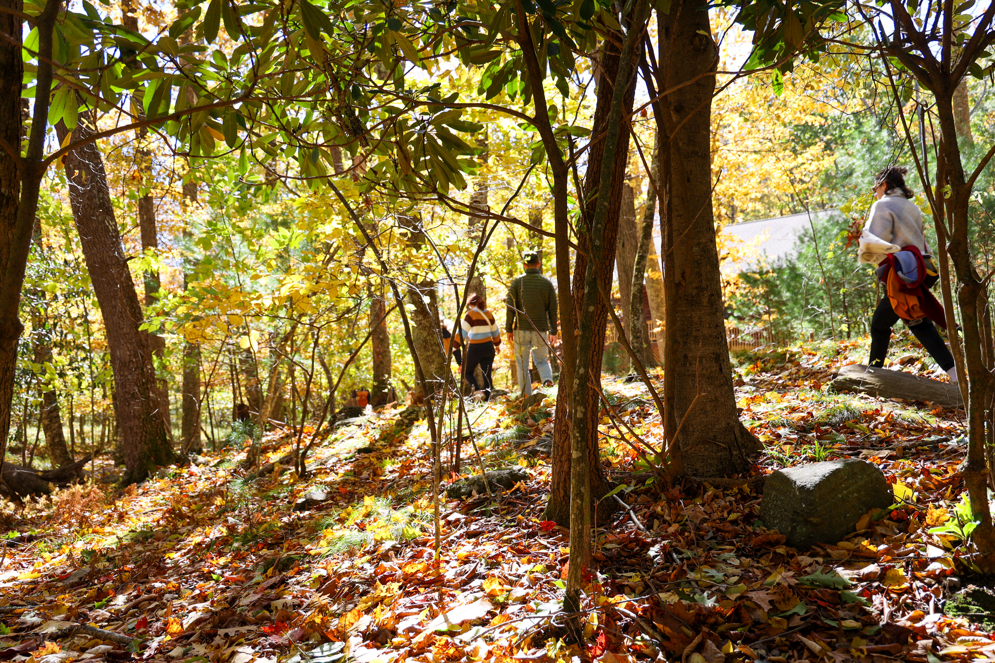
We traveled over to Boone to join the folks at the Blue Ridge Conservancy for their Great Trails State Day Hike at Boone United Trail as part of Year of The Trail! When it comes to trails in the North Carolina High Country, the BRC knows a thing or two — currently protecting and managing more than 25,000 acres throughout the area including some of our favorite local trails, like Glen Burney Falls!
Northern Peaks State Trail Coordinator, Jordan Sellers, gave us a crash course on what goes in to building and managing trails like Boone United Trail, and how everything from fungus, to flowers, to fauna must be considered. This 2.5 mile loop gave us ample time to admire the natural beauty around us, reminded only of our proximity to downtown Boone by the occasional gust of a leaf blower coming from a driveway in a nearby hollow.
Trail Length: 2.5 mile loop
Difficulty: moderate to strenuous
Surface: Natural
Trail Use: Hiking, leashed dogs ok
Blaze: N/A
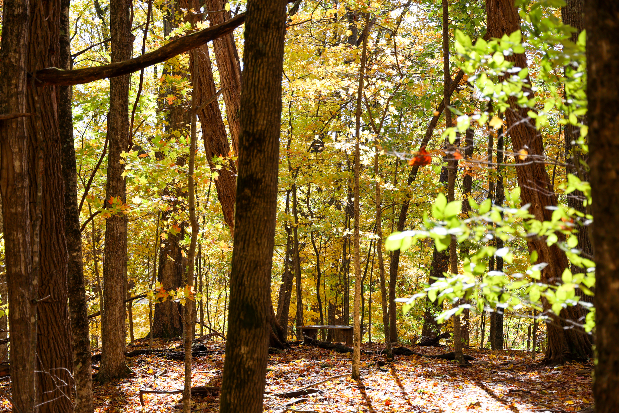
This trail, which leads up near Howards Knob, is great for those looking for a good woodsy hike without having to go very far from town. Without much of an overlook view to speak of, Boone United more than makes up for the lack thereof by providing visitors with a near 360-degree view of gorgeous Fall foliage. Think of it not as looking at the leaves…but being in the leaves!
Located behind Boone United Methodist Church, this trail is open to the public year-round. Rated as moderate, Boone United Trail is steep, but as with nearly all other trails, it gets much easier on the way down! Hiking boots and poles are recommended for the ascent.
Getting There:
From Blowing Rock, take HWY 321 into Boone and keep going straight until the intersection with the Wendy’s. Turn right onto US 221 and take that to the intersection with E. King St. Turn right onto E. King St. then merge into the left lane. Turn left onto New Market Blvd. Take New Market Blvd. to Boone United Methodist Church. Turn into Boone United Methodist Church and continue straight and you will see signage for the Boone United Trail. Park in the church parking lot, cross the bridge, and you will have started the trail!
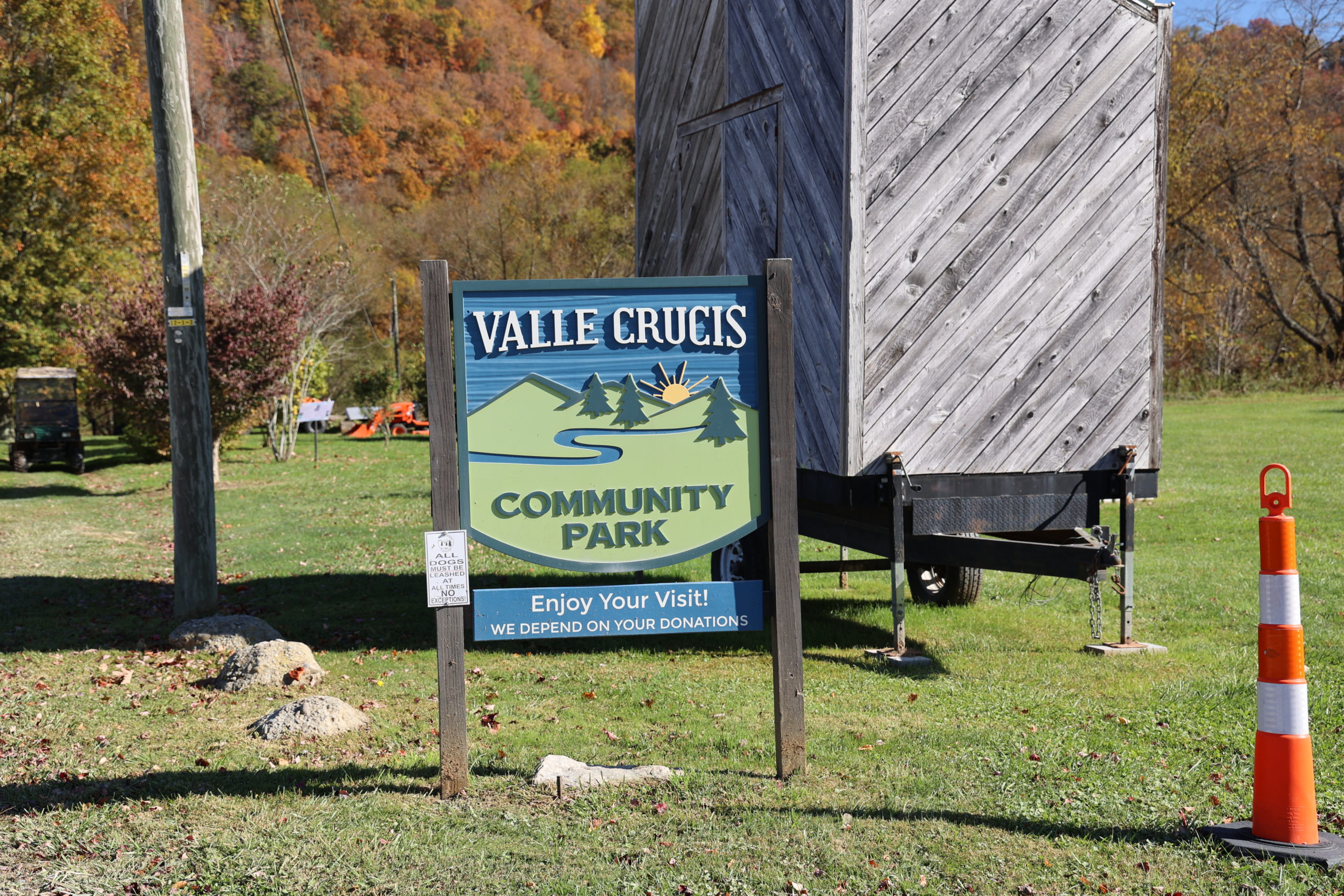
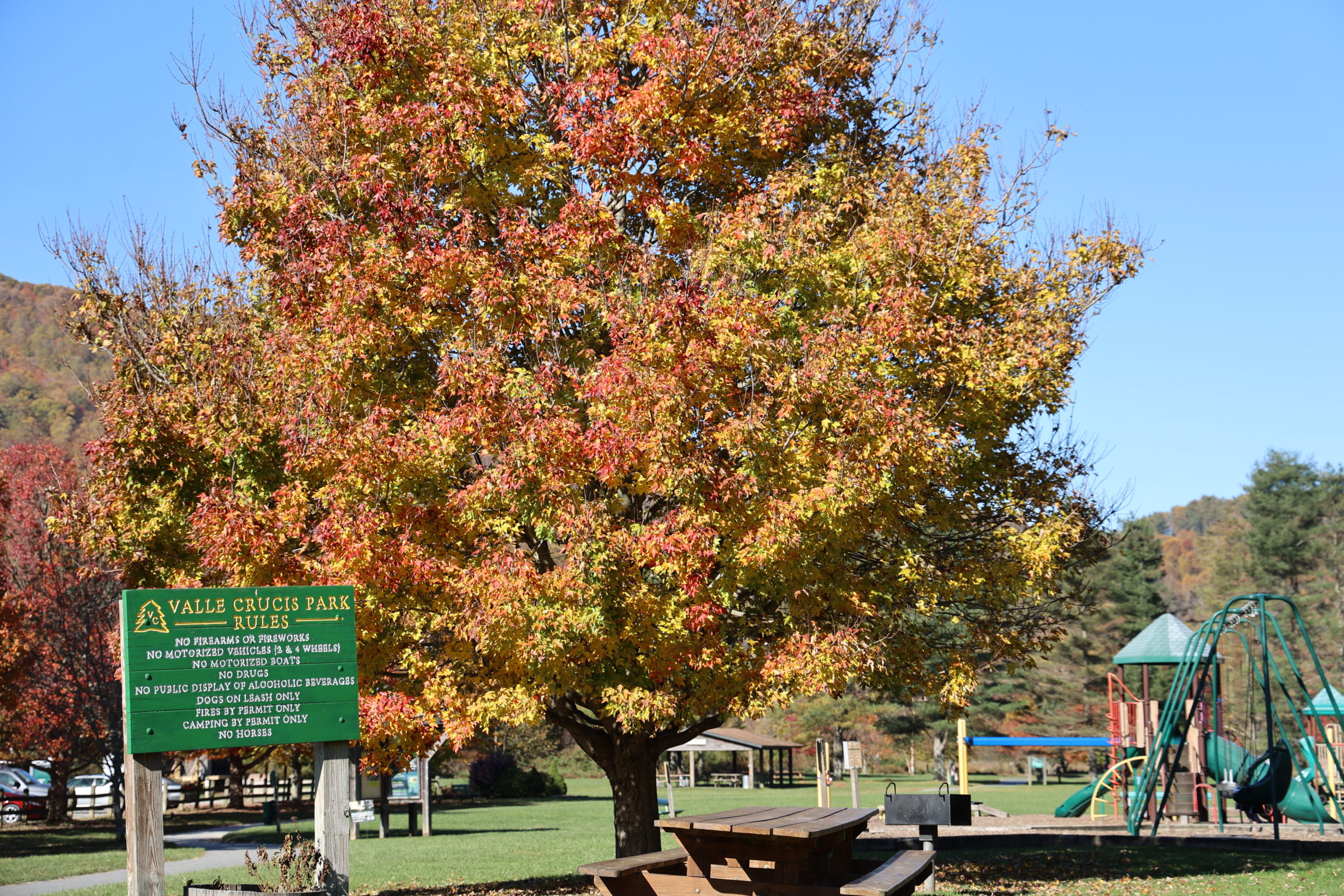
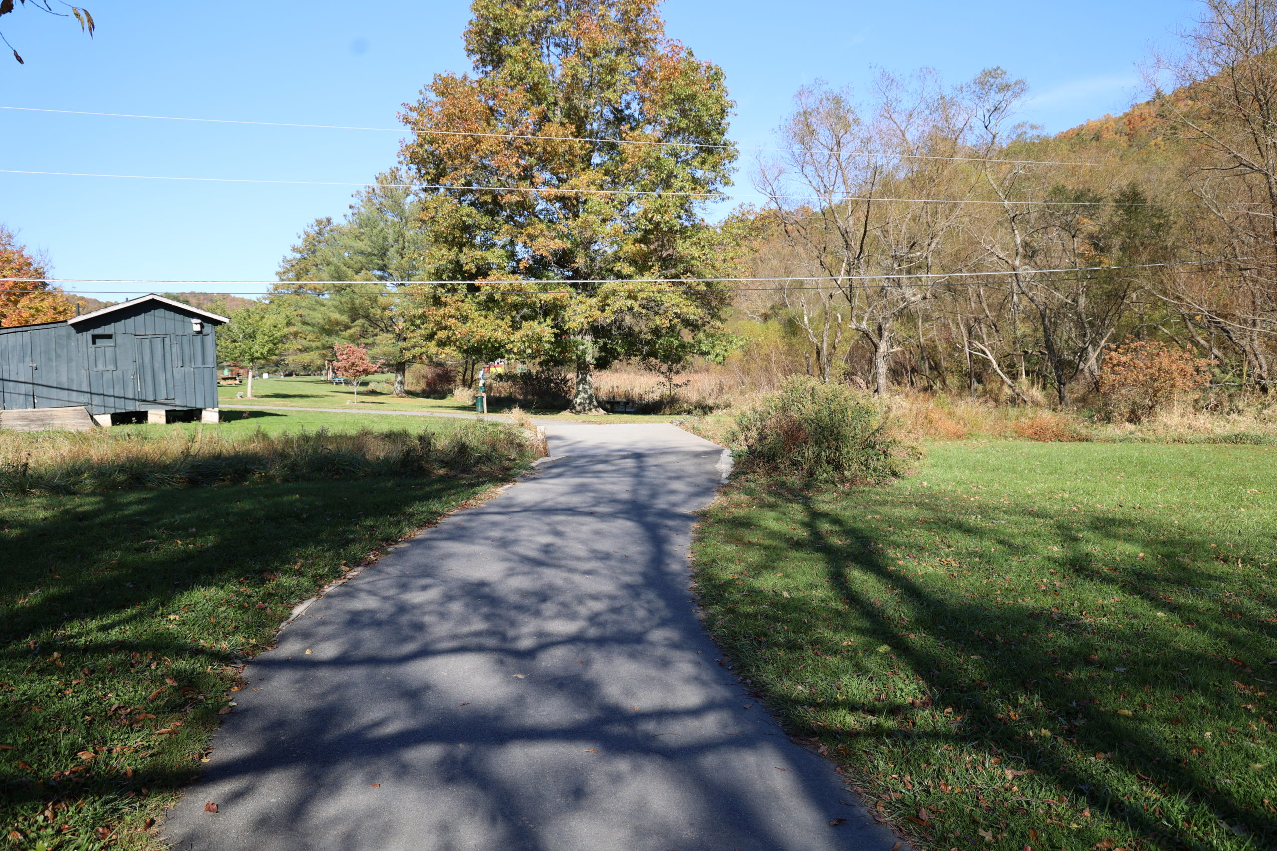
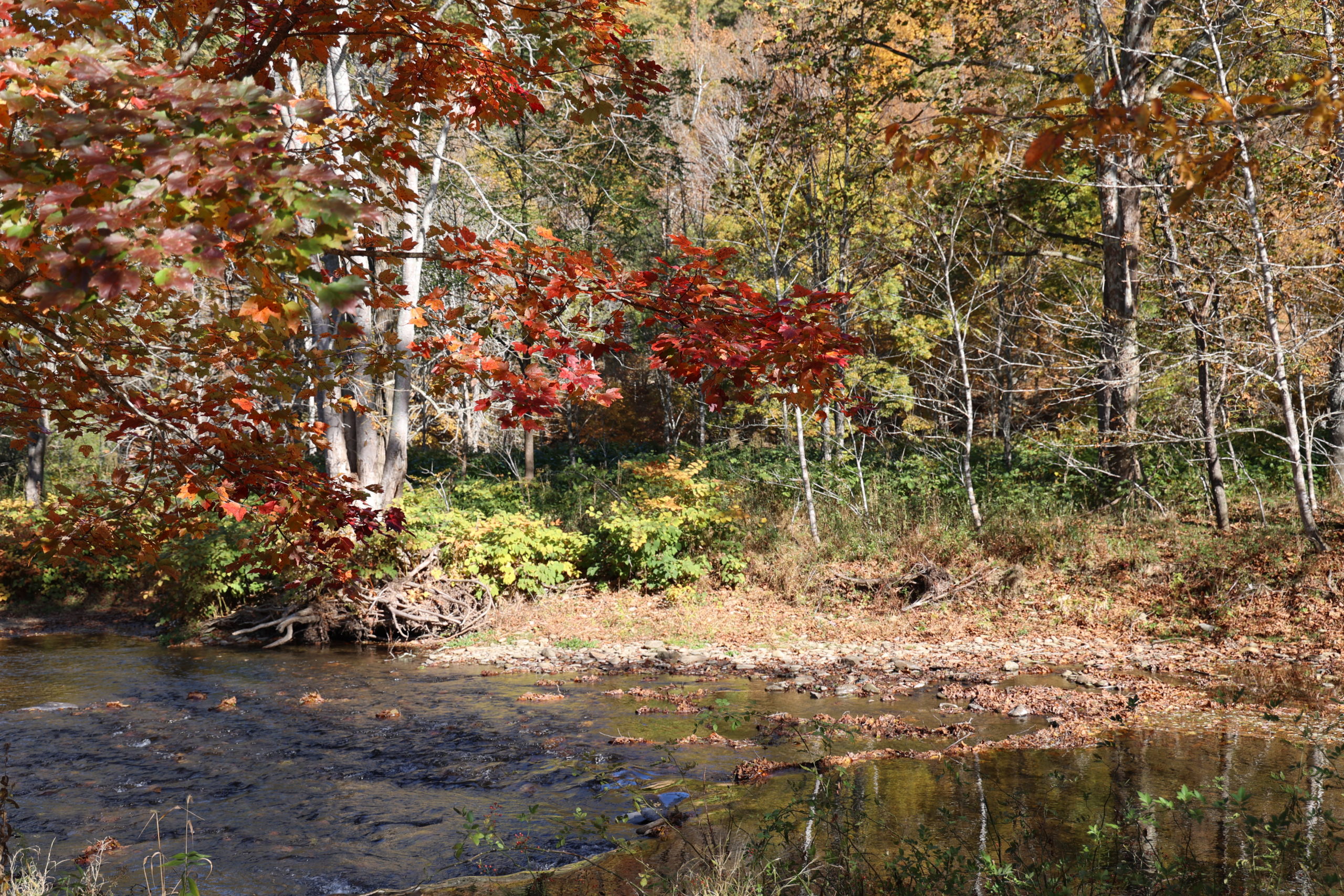
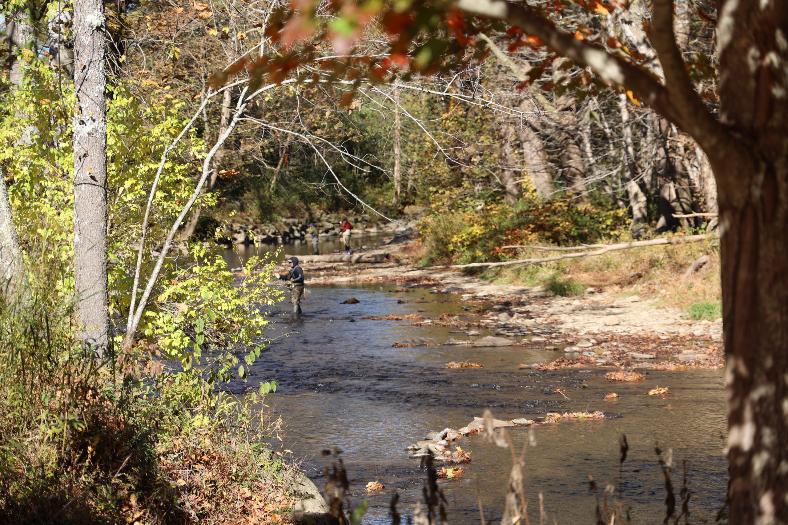
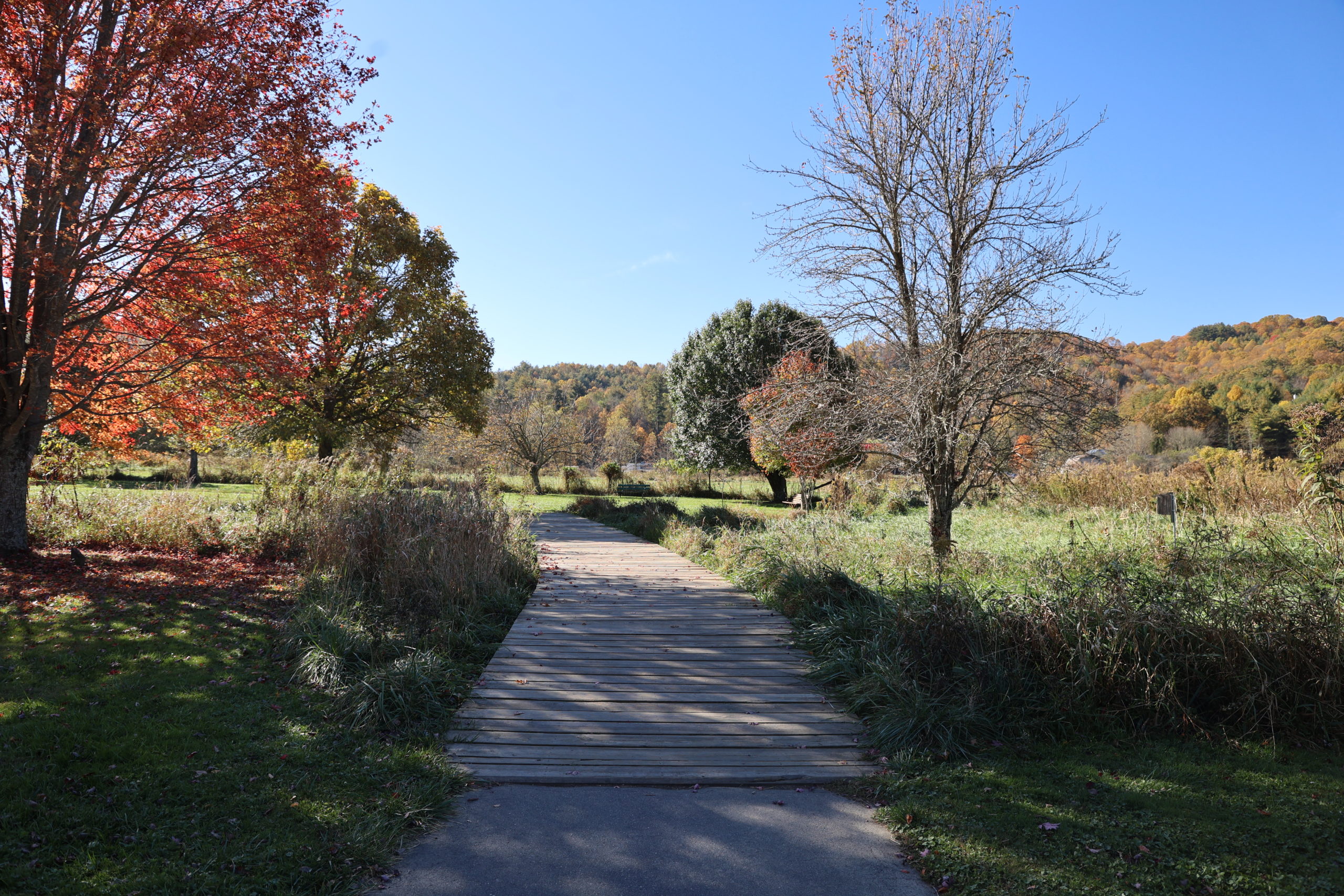
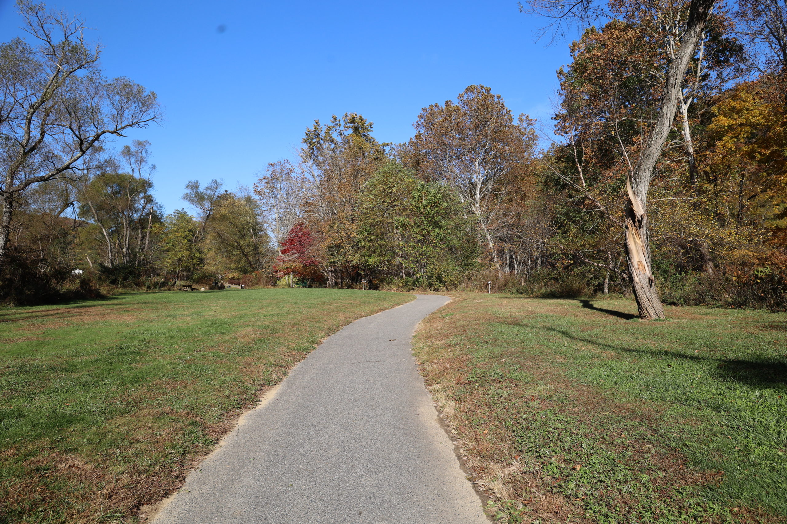
Valle Crucis Park
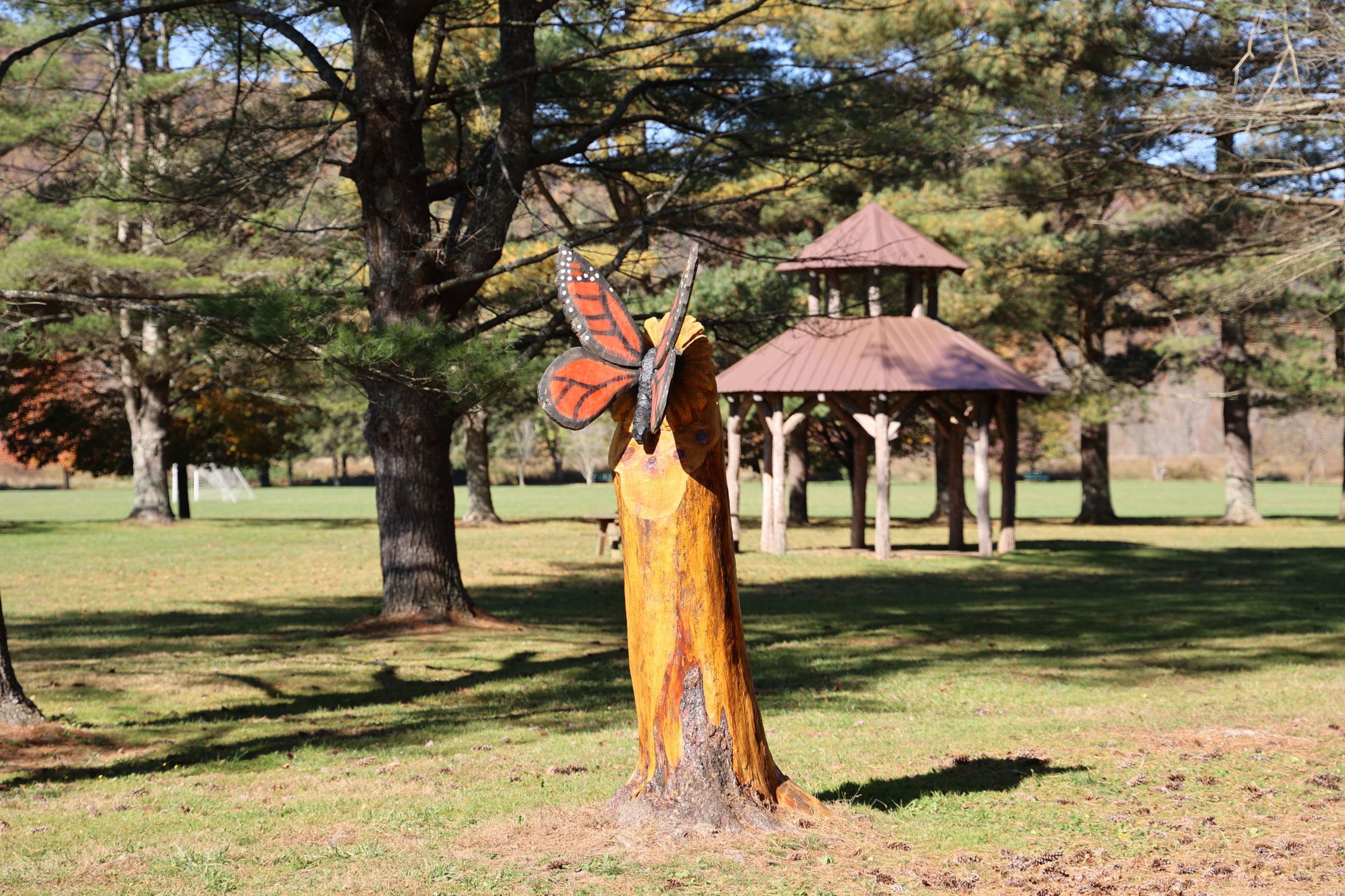
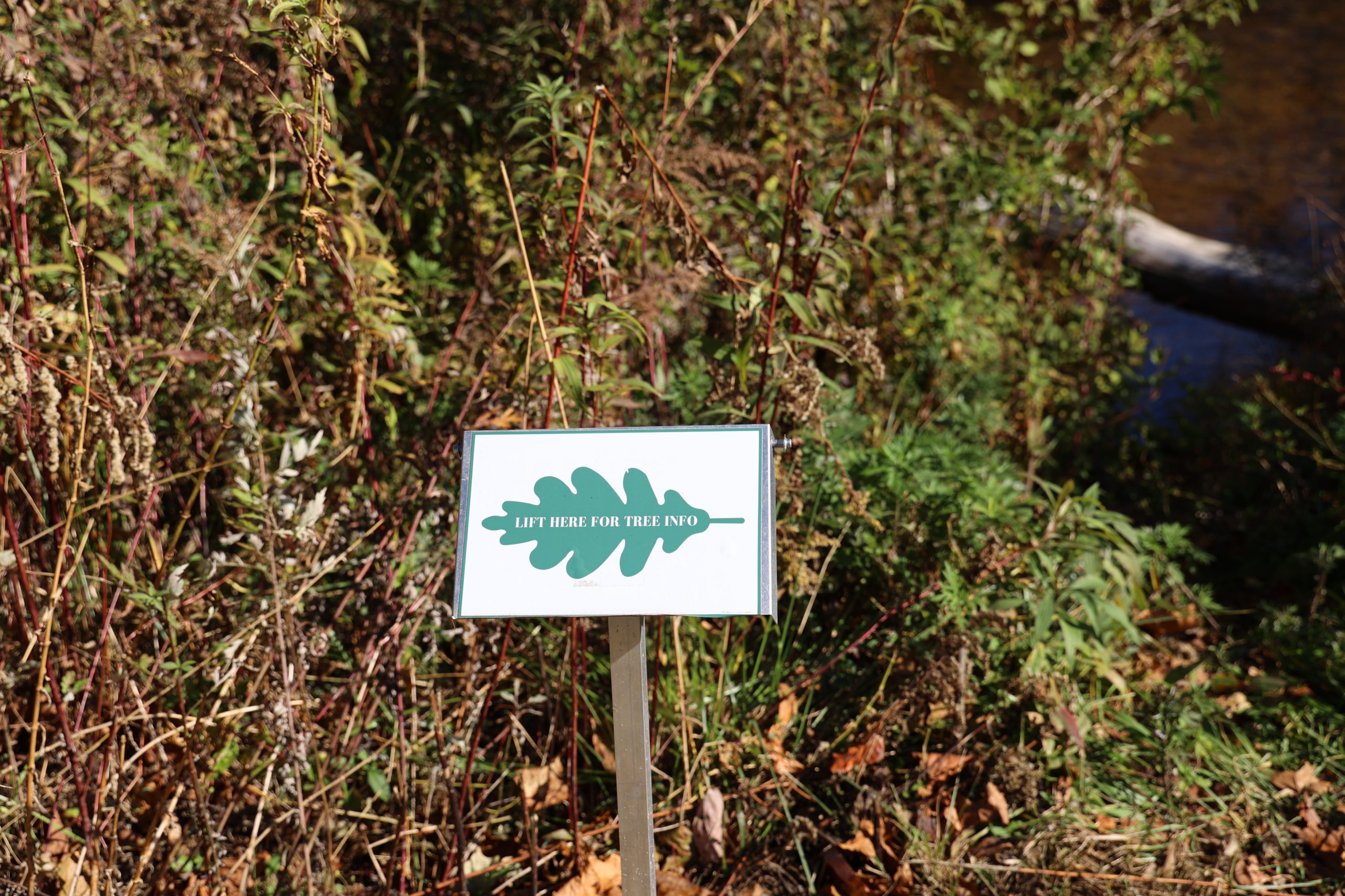
Valle Crucis Park has a paved loop that goes around it. It is almost a mile long and offers tranquil views of the park and the Watauga River. Strolling around it today, the sweet smell of fallen leaves was wafting through the air. The park offers play equipment for children, covered pavillions for picnicing, and a soccer field. There are plenty of benches and picnic tables near the trail as well for resting and enjoying the ambling river. In a certain section, they have had to cut down some trees, but they have carved the stumps into artwork featuring native animal species.
Trail Length: 0.8 mile loop
Difficulty: Easy
Surface: mostly paved with a little gravel and some wooden bridges
Trail Use: walking, jogging, leashed dogs ok
Blaze: NA
Valle Crucis Community Park would be a great place to bring a stroller or a wheelchair. It is paved all the way around, and the bridges are made of concrete or wooden planks. There are no stairs or very steep ascents to worry about. Yet the trail offers plenty of natural views and serene spots to make you feel like you’ve gotten away for awhile.
Getting There:
From Blowing Rock, take Hwy 321 into Boone. Turn left onto Hwy 105 at the intersection with the Wendy’s. Follow 105 out to the intersection of Broadstone Rd. Turn right onto Broadstone Rd. Follow Broadstone Rd. until you see the Mast General Store Annex come into view. Turn right onto the gravel road before the Mast General Store Annex. There will be parking for the Mast General Store Annex, but continue going past it and you will arrive at parking for Valle Crucis Community Park.
Looking Ahead
For November, we’ll continue exploring some great, varied trail options. We’ll be exploring the Cone Fire Tower Trail, the Boone Greenway, and Otter Falls! See more about Year of the Trail in Blowing Rock >> There is also ongoing maintenance on the Parkway. To see if it will affect your hiking plans, see our page: Improvement Projects on the Blue Ridge Parkway.